Create 3D models with speed and ease of use.
GMS - A super intuitive and powerful platform for groundwater and underground simulation.
Accelerating and simplifying model construction using conceptual modeling methods in GMS
We have pioneered conceptual modeling and made years of improvements to it. This is why GMS is the fastest and most intuitive groundwater modeling interface available. Build advanced representations of the model using familiar GIS objects: points, arcs, and polygons, and easily update the model as needed. The starting price for conceptual modeling in GMS is $2670 (including 3D visualization)
For models with simple geometry and boundary conditions, use the grid method and directly edit the values in the grid.
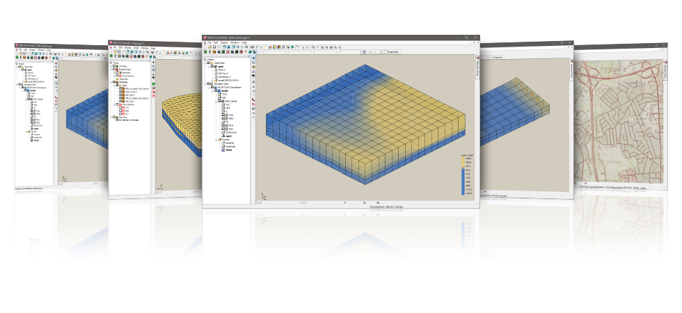
3D visualization for performance optimization
GMS is the most advanced software system that can be used for groundwater simulation in three-dimensional environments.
- Interacting with real 3D models
- Optimize OpenGL graphics to improve hardware rendering
- Create photo realistic renderings
- Generate animations for PowerPoint or web presentations
- Overlay images on the model and control opacity
- Annotations - Add compass, scale, reference image, company logo, etc
Import various data formats and images
The model requires data from many different sources. That's why GMS can easily import multiple file types:
- Raster images, including georeferencing and projection support
- Topographic maps and elevation data
- Drilling data includes stratigraphic and geophysical data
- Native MODFLOW file
- MODFLOW files from Visual MODFLOW, Groundwater Vista, and PM Win
- Network data services, such as TerraServer
- ArcGIS geographical database and shapefile
- CAD files, including. dwg,. dgn, and. dxf formats
- Global projection support, including Cartesian and geographic systems
- File Import Wizard for Separating Text Files and Spreadsheets
Advanced underground characterization
From cross-sectional editing to advanced probability statistics, GMS provides unparalleled underground modeling tools.
- Generating Isosurfaces from 3D Data to Visualize Plume Flows
- Cutting cross sections at any position using 3D data
- 2D and 3D geostatistics - Kriging, IDW and natural neighborhood
- A powerful and fast algorithm for creating entities from the horizon
GMS 10.5 System Requirements
- Operating system: Windows 10
- Memory: It is recommended to use 16GB or larger
- CPU: GMS software is CPU intensive. Some models and utilities integrated with GMS can utilize multiple processor cores simultaneously. We recommend using the fastest CPU allowed by the budget.
- Storage: The recommended storage amount will vary depending on each data requirement. The latest version of GMS consumes a lot of disk I/O resources.
-Mechanical hard drives: basic performance
-SATA Solid State Drive: Better
- Performance - NVMe Solid State Drive: Best Performance
Graphics card: Dedicated graphics cards are better than integrated graphics cards. Basic or mid range nVidia cards designed specifically for gaming work best.
Display resolution: 1920 x 1080 or higher