WMS - Multi in One Watershed Solution, Complete Multi in One Watershed Solution
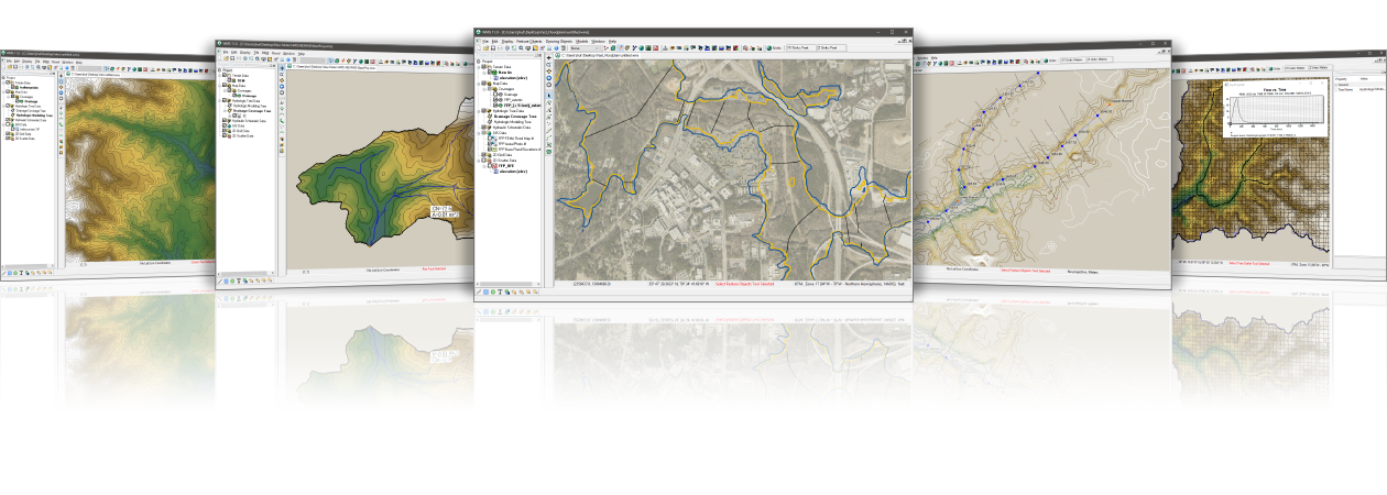
- Geographic Information System Tools
- Network based data collection tool
- Terrain data import and editing tools
- Automatic watershed delineation and hydrological modeling
- Supporting the most industry standard hydrological models
- Step by Step Hydrological Modeling Wizard
- Hydraulic modeling and floodplain mapping
- Rainwater channel modeling
- Two dimensional (distributed) hydrology
- Integration with FHWA hydraulic calculation software
- Export WMS animation to Google TM Earth
Automatic watershed delineation and hydrological modeling
- Automatic delineation of watersheds and sub watersheds using digital terrain data
- Automatic computational geometry of geometric watershed data, such as area, slope, average elevation, maximum flow distance, etc
- Calculate hydrological basin data such as concentrated time, number of curves, and infiltration parameters with a small amount of input
- WMS contains industry standard equations for calculating sub basin lag time and concentration time
- Add any number of internal exit points to allow WMS to automatically subdivide the watershed
- Manipulate the river network to represent human characteristics or propose changes to the watershed
- Overlay derived watershed boundaries to match your understanding of the watershed
Supports most industry standard hydrological models
- The license for WMS Floodplain or higher includes interfaces to the following industry standard hydrological models:
- HEC-1
- HEC-HMS
- TR-20
- TR-55
- Rational methods
- Modlat
- OC (Orange County, California) Rationality
- OC Hydrology
- High-density lipoprotein
- National traffic statistics
- Convert and compare the watershed results developed for a model with any other models supported by WMS
- Read and compare the observed hydrograph with the calculated hydrograph
Hydraulic modeling and floodplain mapping
- Define river centerline and embankment stations
- Define cross-sectional position
- Automatically cut cross sections and derive Manning's roughness values from elevation and ground material data
- Export the cross-section to HEC-RAS or a simplified hydraulic model for dam rupture
- Run hydraulic model and read water level elevation back to WMS
- Reading water surface elevation data from hydraulic models or manually entering known water surface elevations
- Creating flood range and depth maps using digital terrain data and water surface elevation data points
- Link peak flow or complete hydrological hydrographs from any WMS supported hydrological model to the HEC-RAS hydrological model
Rainwater channel modeling
- Draw a rainwater channel network or import the network from GIS
- Calculate the elevation, length, and slope of pipelines based on basic elevation data
- Link the rainwater drainage network to your hydrological model data
- Export hydrological model data and rainwater discharge network to EPA-SWMM or XP-SWMM
- Import existing EPA-SWMM or XP-SWMM files into WMS
Two dimensional (distributed) hydrology
- WMS supports 2D models:
- US Army Corps of Engineers (USACE) GSSHA Model
- HMS version of quasi distributed MODClark method
- Flood prediction (depth and velocity of the entire two-dimensional domain)
- Thunderstorm (Local Rainfall) Flood Analysis
- Analysis of surface water accumulation and infiltration
- Wetland modeling
- Modeling the Impact of Land Use Change
- Modeling the interaction between groundwater and surface water
- Sediment and pollutant modeling
Import what you need
- USGS DEM - Download and use any format of DEM from USGS
- USGS NED data - seamless elevation data can be downloaded and read into WMS
- ArcGIS Raster (ASCII format) - Reading elevation or attribute data in grid format from ArcGIS
- ESRI Shape File - Read all shapes and attributes into WMS
- DXF and DWG CAD files - WMS now supports the latest versions of DXF and DWG
- WMS can read TIFF, JPEG image files -/images, and geographic reference information
- Any data supported by ArcGIS can be read into WMS (requires ArcGIS license, compatible with ArcGIS 10.0)
WMS 11.1 System Requirements
- Operating system: Windows 10
- RAM: 16GB or more recommended
- CPU: WMS software is CPU intensive. Some models and utilities integrated with WMS can utilize multiple processor kernels simultaneously. We recommend the fastest CPU allowed in your budget.
- Storage: The recommended storage amount will vary depending on personal data requirements. The latest version of WMS is disk I/O intensive.
-Mechanical hard drives: basic performance
-SATA solid-state drives: better performance
-NVMe solid-state drives: optimal performance
- Graphics card: Independent graphics card is superior to integrated graphics card. Basic or mid range nVidia cards designed specifically for gaming work best.
- Display resolution: 1920 x 1080 or higher